


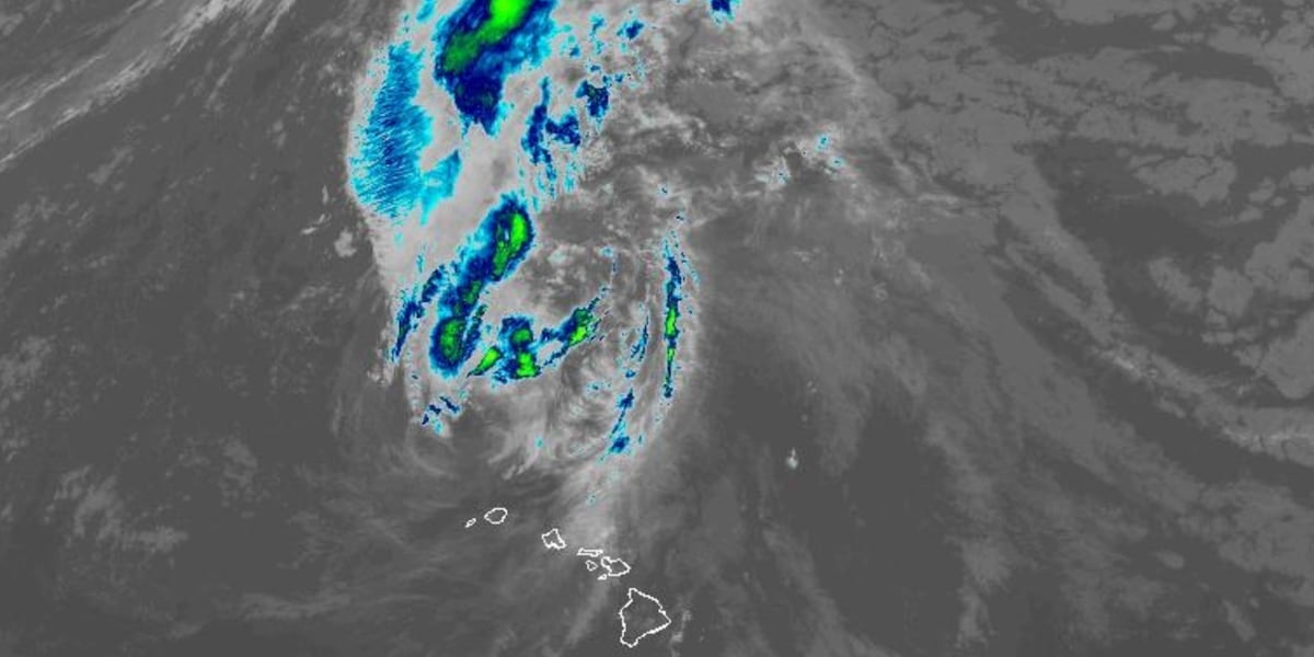

HONOLULU (HawaiiNewsNow) – Lowell is now barely a hurricane and continues pulling further away from the main Hawaiian islands after passing just west of Niihau as a Category 2 hurricane, battering Kauai County with high winds and hurricane-force gusts.
All coastal warnings have been canceled, but there is still a risk of flash flooding from moisture trailing behind the tropical cyclone.
At 11 a.m. Tuesday, Lowell was 230 miles north-northwest of Lihue and was moving to the north at 15 miles per hour.
Lowell has weakened to a category 1 hurricane, with maximum sustained winds at 75 miles per hour. Hurricane force winds extend outward up to 60 miles from the center, while tropical storm force winds extend outward up to 205 miles.
As Lowell made its closest pass, Barking Sands reported sustained winds of 51 miles per hour with an 84 mile per hour gust, while Lihue Airport reported winds of 54 miles per hour and a gust to 79 miles per hour.
Lowell’s track now pulling it north
Lowell is now moving north and further away from Kauai County after a few days of traveling in the north-northeast direction. It is forecast to turn to the northwest and then west Wednesday and Thursday as it continues to track away from Hawaii.
Lowell is expected to weaken to a tropical storm by Tuesday evening.
Local alerts for Hawaii
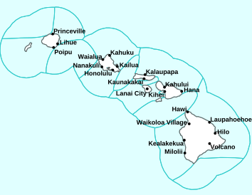
A Flood Watch remains in effect for all Hawaiian islands. Heavy rain will be possible from trailing moisture along the eastern flank of Lowell.
High Surf Warnings remain in effect for the south-facing shores of all islands through 6 p.m. Tuesday.
- Kauai and Niihau: Surf of 20 to 30 feet, declining rapidly to 6 to 8 feet Tuesday afternoon.
- Oahu: Surf of 15 to 25 feet, declining rapidly.
- Maui County and Hawaii Island: Surf of 12 to 20 feet, declining rapidly.
A High Surf Warning is also posted for the west shores of Hawaii Island. for waves up to 12 to 16 feet, also declining rapidly through Tuesday.
A High Surf Advisory has also been issued until 6 p.m. Tuesday for the east-facing shores of Oahu, Molokai, Maui and Hawaii Island for waves of 7 to 10 feet.
Ongoing impacts
RAIN: Lowell may still produce additional rainfall totals of 2 to 4 inches for Kauai, with maximum storm totals of 24 inches possible. For the Big Island, an additional 3 to 6 inches of rain is expected with isolated storm totals of 8 inches possible. For Oahu and Maui County, an additional 1 to 3 inches of rain is expected with isolated storm totals of 8 inches possible. This rainfall may produce significant flash flooding and mudslides, especially across Kauai County and portions of Hawaii Island.

STORM SURGE: Ocean water levels may still be elevated along the coasts of Niihau, Kauai and Oahu due to large waves. Storm surge effects should subside after the next high tide.
SURF: Swells from Lowell are still high but will diminish rapidly through the day Tuesday.
Remain prepared for hurricane season
This continues to be an active hurricane season. Have a hurricane plan and supply kit in place.
Data provided by the National Hurricane Center.
Related posts
- Get the latest First Alert Forecast
- How to build a hurricane kit: Tips to help your family prepare for emergencies
Download the HNN Weather app from the Apple App Store or Google Play for the latest updates from your First Alert Weather Team: chief meteorologist Jennifer Robbins and weather anchors Guy Hagi, Dan Cooke, Ben Gutierrez, and Billy V.
Copyright 2026 Hawaii News Now. All rights reserved.