

LAS VEGAS, Nev. (FOX5) – It’s a map designed to help you find affordable food in your neighborhood, and community leaders plan the future of the Las Vegas Valley.
The 2025 healthy food access map is officially online, and only FOX5 is getting an inside look at how it works from its’ developers.
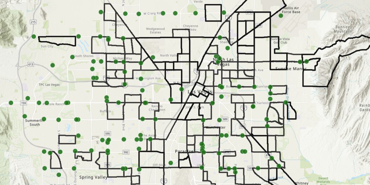
When you open the map, you will see all of the green dots are major grocery stores that accept SNAP benefits. The areas highlighted in black are ‘food insecure areas’ which are zip codes where people are making 200 percent of the federal poverty line and are living more than half a mile away from a major grocery store.
“Food insecurity has really become a worsening issue, especially since the pandemic. We’ve become a really food-insecure state,” said Dr. Sabina Malik with the Southern Nevada Food Council. “If you’re having a hard time finding food or if you’re struggling to get groceries, this is the way to help you identify where there are more places where you can get these items,” she added.
Other tabs of the map highlight additional food resources, like food pantries and farmers markets.
It also highlights RTC bus routes, so users can find the fastest way to get there. RTC officials say they’ll use the map to plan their services in the future, with the hope of making it easier for everyone to access healthy food.
You can find the interactive map here.
Copyright 2025 KVVU. All rights reserved.