
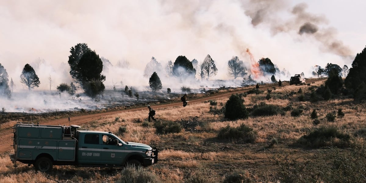
WHITE SAGE, AZ (AZFamily) — Highway closures and evacuations remain in effect as a wildfire burns more than 58,000 acres in far northern Coconino County. It is one of two blazes raging at or near the northern rim of the Grand Canyon.
As of July 18, the fire has grown to 58,631 acres with 27% containment. Firefighters say they have made considerable progress on the west side of the fireline, particularly marking significant containment on northwest perimeter.
In the coming days, crews should be able to further reinforce containment lines as they get a better handle of the blaze thanks to the weather conditions.
“Overall we got a bit of moisture,” said Jesse Trembly, deputy operations section chief for the Bureau of Land Management, during Friday’s operational update. “That really, really mellowed things out and knocked down the fire behavior. So we’re feeling really good.”
On July 13, Very Large Air Tankers (VLATs) and Single Engine Air Tankers (SEATs) dropped 179,597 gallons of fire retardant along the northern and southern perimeters to slow the spread. Officials reported the line held well on the west side of the fire near its point of origin.
Forestry officials say extreme fire behavior pushed the fire southward across Highway 89A near House Rock Valley on that day, making it the most active edge of the incident.
Lightning sparked the White Sage Fire on the evening of July 9, about 15 miles southeast of Fredonia.
Nearby wildfire destroys Grand Canyon lodge
The Dragon Bravo Fire, which has burned about 5,000 acres as of July 13, destroyed approximately 70 buildings at the Grand Canyon’s northern rim, including a historic lodge, a water treatment plant, visitor center and gas station.
Grand Canyon officials said the wildfire forced it to close visitor access to the North Rim through the end of the season.
Park officials previously evacuated about 500 guests on Friday before ultimately forcing employees and residents to also leave.
Crews had reported a day earlier that a water treatment plant had caught fire, causing chlorine gas to be released from the facility which prompted health concerns for those who remained on the inner canyon.
All river trips had been instructed to bypass Phantom Ranch, the National Park Service said. North Kaibab Trail, Phantom Ranch, and the South Kaibab Trail remain closed until further notice.
Meanwhile, those living in Marble Canyon, Lees Ferry, and a small area of the Navajo Nation are advised that they may also smell the chlorine.
Evacuation orders and road closures
The Coconino County Sheriff’s Office said the following area must evacuate:
- North boundary: Utah Border
- East boundary: House Rock Valley Road/Buffalo Ranch Road
- West boundary: Kaibab National Forest Boundary
- South boundary: Grand Canyon National Park
Southbound U.S. 89A is closed at state Route 389 in Fredonia, while northbound U.S. 89A is closed at U.S. 89 in Bitter Springs.
“A road closure is not a decision that is made lightly. We recognize the impact of closing off a highway, but keeping our firefighters and the public safe is our highest priority,” the BLM said.
Approximately 467 fire personnel are battling the blaze. For a detailed map, click/tap here.

See a spelling or grammatical error in our story? Please click here to report it.
Do you have a photo or video of a breaking news story? Send it to us here with a brief description.
Copyright 2025 KTVK/KPHO. All rights reserved.