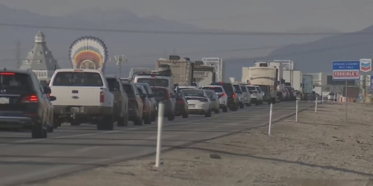




LAS VEGAS (FOX5) — I-15 is a lifeline for tourism, trucking and freight, and it runs through the heart of southern Nevada. State transportation leaders are launching a long-range study on how the corridor from the California line up to Sloan should look decades from now.
NDOT says nearly 50,000 vehicles travel between Jean and Las Vegas every day, a number expected to grow as new homes, warehouses and industrial projects fill in around Jean and Primm, and as Clark County and Henderson plan development on tens of thousands of acres to the west.
MORE ON FOX5: New Ford proposal would expand PUCN, place restrictions on data centers
Brightline, new airport factored into planning
The study will also factor in Brightline West high-speed rail, which could eventually take an estimated 24,000 cars a day off the highway, and a new supplemental airport near Ivanpah that could open as soon as 2037. NDOT is looking at options like new interchanges, better local road connections, and backup routes for when I-15 shuts down, like after the lithium battery truck fire.
Proposed Solutions
Currently, the I-15 chokes down to three lanes in each direction between Stateline and Sloan, creating brutal weekend gridlock in extreme desert heat—especially during accidents or emergencies.
To keep traffic moving, NDOT’s long-term recommendations include:
- Widening the Freeway: Expanding I-15 to four lanes in each direction south of Sloan.
- Creating New Bypasses: Constructing new highway connections from I-15 to roadways like U.S. 95 and State Route 160 to give drivers alternative routes during major closures.
- Modernizing Interchanges: Completely reconstructing outdated structures, such as the Jean Interchange, which was built in 1958 and currently constricts traffic to just one lane in each direction.
- Transit & Rail Integrations: Expanding truck parking, updating weigh stations, and building emergency vehicle crossings alongside the planned Brightline West high-speed rail line.
Airport Expansion Sparks Soil and Water Concerns
A driving force behind the highway expansion is the proposed Southern Nevada Supplemental Airport (SNSA) near Jean. Clark County land development plans currently stretch toward a 2037 completion timeline, with key federal environmental approvals expected within the next two to three years.
However, the massive scale of the proposed airport has some long-time residents raising red flags about the local terrain.
John Hiatt, a concerned citizen and former chairman of the Enterprise Town Advisory Board, pointed out that the airport’s layout encroaches heavily on a lake—an area he says is prone to sudden desert flooding and unstable ground.
“Apparently there’s no regard for the fact that this is a lake which is dry now, but floods when it rains, and how that will be dealt with,” Hiatt said. “And also, my understanding from discussions with the Bureau of Land Management is that the soils in that lake bed are very, very soft. They don’t support much.”
Building the airport on the lake bed would require what Hiatt describes as “the largest earth-moving exercise in the history of Clark County, if not all of Nevada.”
NDOT officials say public feedback from meetings like Wednesday’s will be used to shape and refine the ongoing corridor study.
Public meeting set for Wednesday
Drivers who use that stretch can weigh in Wednesday. NDOT will host an open house at South Career and Technical Academy on East Starr Avenue. Doors open at 4 p.m., with a presentation and Q&A starting at 5:30 p.m.
Details and comment submissions are available on the NDOT I-15 Stateline to Sloan website. The meeting will also be streamed live on NDOT’s Facebook page.
You can also submit your public comment by visiting this website.
Copyright 2026 KVVU. All rights reserved.